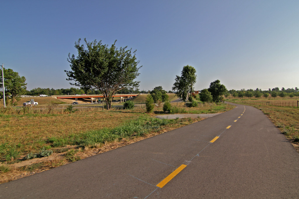
Meadow Valley Trail runs east from Porter Road near the I-540 overpass to Scull Creek Trail.
Photos: Todd Gill, Flyer staff
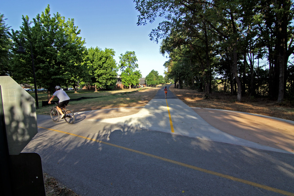
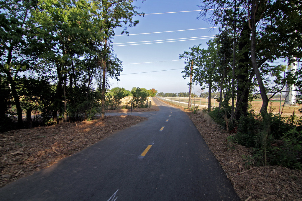
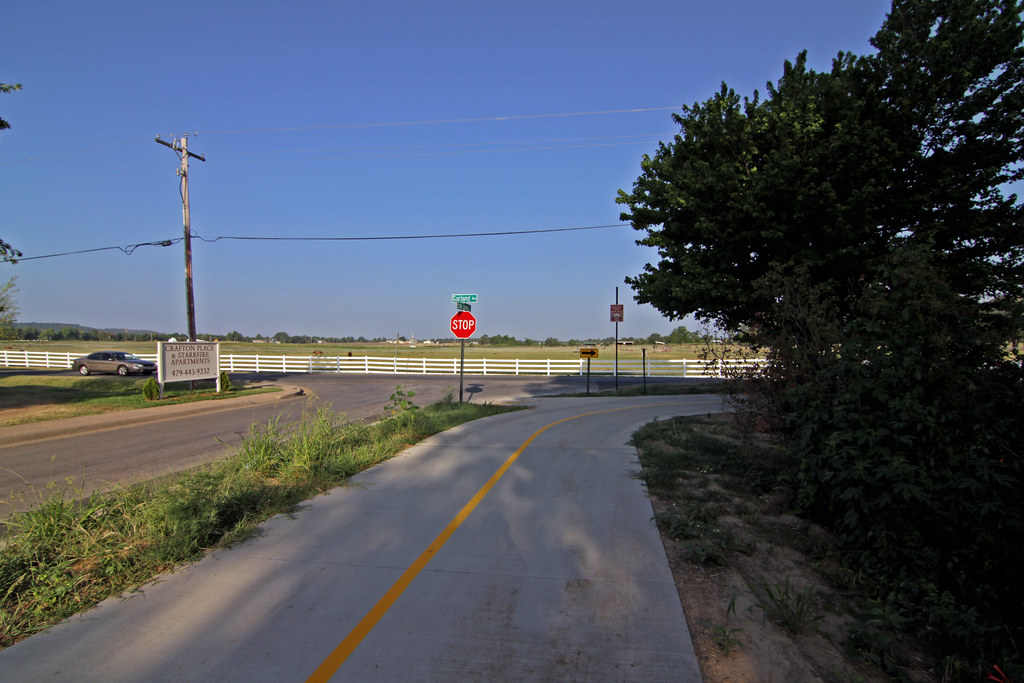
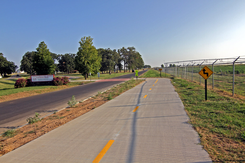
Construction is finally complete on Meadow Valley Trail, one of the most highly anticipated trail connections in Fayetteville.
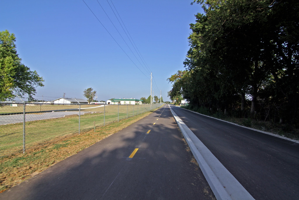
The 2.3-mile trail runs west from Scull Creek Trail to Porter Road near the Interstate 540 interchange, providing a link between the backbone of the city’s trail system and the neighborhoods to the west of I-540.
Trails coordinator Matt Mihalevich said an official ribbon-cutting ceremony will be held sometime in early August, but for now, the trail is fully complete and ready for use.
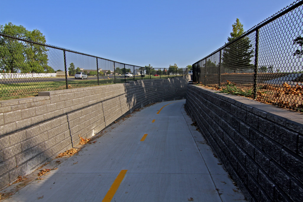
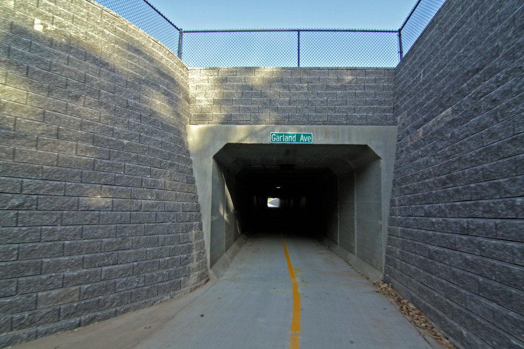
One of the trail’s biggest highlights is a tunnel under Garland Avenue (Arkansas Highway 112) that measures 12 feet wide and 10 feet tall. The 270-foot tunnel stretches from Agri Park on the east side of Garland to the Pauline Whitaker Animal Science Arena on Knapp Drive near the entrance of the Washington County Fairgrounds.
This is the first tunnel built exclusively for the trail system. The handful of other trail tunnels in Fayetteville are storm drains that were adapted to allow for bike and pedestrian use.
The tunnel’s lighting system stays on 24 hours a day, with the exception of the outermost energy-saving photocell units which automatically turn off during daylight hours.
We rode on the trail Tuesday morning and the only thing we saw that had yet to be installed were the two rest area benches planned at the intersection of Scull Creek Trail. Wayfinding signage, mile markers and other signs are already in place.
Once state permits are approved, crews will begin construction of bike lanes an on-street trail along Porter Road which will connect Meadow Valley Trail to the existing bike lanes on Mount Comfort Road.
Here are a few photos we took while riding west from the Scull Creek Trail intersection. The route takes trail users past the University of Arkansas farm trails, the UA’s Agri Park, underneath Garland Avenue, past the Washington County Fairgrounds and the Arkansas Music Pavilion and ends at Porter Road near the I-540 interchange.


Awesome! I love the trail intersection in the first picture. That’s how intersections should be done!
In the near future, I’d love to see other trail intersections upgraded to function the same way. This configuration makes room for benches, water fountains, bicycle repair towers, and emergency call towers. Making plans to add that kind of stuff is something we need to do if we want a world-class trail system.
haha, bike trail across the street from that terrible house full of republicans and hummers. Love it.
Shocking I know, but not every cyclist is a leftist liberal hippie…
…nor is every person who dislikes Republicans and Hummers.
This is awesome. But, how about those of use who live in the neighborhoods off of west Wedington? Do we have to ride up Rupple Rd. to Mt. Comfort, etc. in order to get east of 540? Not complaining – just wondering if there is a more direct bike route from Wedington currently or if one is in the works (other than actually riding on Wedington, over the interstate, which I don’t feel safe doing).
sorry, those of *us*
None that I’m aware of; pretty much ride Wedington east, head south to HWY62 and go east or head north to this new extension.
Matt Mihalevich said the city plans to construct an extension of Shiloh Trail from Moore Lane south to Wedington in 2014. This trail will also connect Hamestring Creek Trail. For now, Rupple Rd. to Mt. Comfort is probably the best way to go.
It’s more long-term, but a cycle track (it’s like a trail but it’s between the sidewalk and the road and it’s separated from the road by trees or curb) is planned for Van Asche as a connection to the Clabber Creek trail.
What’s the difference between an on-street trail and a bike lane?
I’m not positive, but it could be that an on-street trail has a curb separation? It could be a misnomer, I suppose. I should’ve asked before including that info in my story. Sorry about that. I’ll look into it.
Todd pretty much got it. The industry refers to these as “cycle tracks” and they can be separated from the road by curb, trees, lamp posts, bollards, or raised to a different height from the street. They can be one-way on each side of the road or two-way on one side of the ride, as in this case.
If you really want to get nerdy about bikeway design, read this: http://nacto.org/cities-for-cycling/design-guide/
Food for thought: Sydney Builds Separate Bike Lanes, Ridership Skyrockets 82%, http://www.treehugger.com/bikes/sydney-builds-separate-bike-lanes-ridership-skyrockets-82.html
Does anyone know if the city plans on planting trees along the trail?
How impressive this is all depends on what the original numbers of cyclist was in Sydney. 82% increase of 10 people is 18 people. As a percentage that is good but depending on numbers it might not be worth the money. I am all for trails but percentages without numbers seem suspect.
It makes me feel great to see this work continue. We need eastern connections to dense population areas, as well. Matt, are we still getting corridor land donated for tax incentives like we were?
And if the stair is for bicyclists with bikes, there should be a ramp about 12-16 inches wide on both sides so the bike can be rolled up and down instead of having to roll it over the steps.
As a resident of West Fayetteville off Porter, this is really good news. I walked the new trail and checked out the tunnel last weekend. There is a mystery trail on the west side of 540 that just ends at the southbound 540 lane, its about halfway between the Porter and Wedington exits in a wooded area. What is this for, and will it ever connect? It looks like it was designed to either go over or under 540 at some point in the future.
Its currently unwise to travel on the road under 540 on a bike at Porter, as the uphill road both ways means that cyclists are unable to match traffic speeds, and heavy traffic means you end up with a lot of motorists in the oncoming lanes trying to pass bikers. Looking forward to the bike lanes! Really excited about this, plan to use it a lot.
Ok, help me understand. Why are we having a ribbon-cutting for something that is already open? I mean, I can understand having a ribbon-cutting and celebration when something like this is first opened to the public, but “sometime in early August” means at least a couple of weeks away. Seems kind of anti-climactic and sort of a waste of money. I mean, it’s not like they didn’t know when they were going to open the thing up. Why couldn’t they have planned a big deal ribbon-cutting/opening celebration for it at that time?
But…hey. That’s just my opinion.
First of August is next week, but yeah having a ribbon cutting/grand opening AFTER being open for a while has always seemed pointlessly stupid to me.
Can’t fix stupid.
Duh, how else would our politicians get on TV? Don’t forget the silly hub-bub they made over the roundabout. Like they invented time travel or something…
A ribbon-cutting doesn’t really cost anything, the name is symbolic. Any expansion project needs at least some basic promotion, that’s media, and through them the citizens of fayetteville, find out about the project. Not all media sources are as diligent and thorough as the Flyer :)
Mmmm….really? What about the staff time to plan and execute? What about any refreshments or other things they may have there? When you say a ribbon-cutting “doesn’t really cost anything” are you implying that is doesn’t cost very much, or is totally without financial expenditure? It looks like this expansion project has already gotten some basic promotion, and will receive more I am sure. I’m not opposed to a ribbon-cutting/opening celebration. It just seems very anti-climactic and just an exercise in self-aggrandizment (sp?) to do it “sometime in early August” and not associated at all with the actual opening of the trail. They will lose a great deal of the excitement and anticipation of the new facility, and as a result a great deal of potential publicity. In other words, by the time they get to doing the ‘ribbon-cutting’ it will no longer be a big deal.
jmo
I’d say its pretty much without expenditure unless they’re going to bring in a brass band. Press conference/ribbon cutting takes about half a day to plan, just tell the press when to show up and get the speaker in place. Doubt there’s refreshments, they’re not designed for people to hang around, especially outdoors. Staff time would be from staff that are pretty much hired to do exactly this kind of thing on a regular basis.
Most ribbon cuttings/openings for businesses, works, etc. do not occur the minute something becomes available. It is a symbolic event, and the day the last of the concrete sets may not exactly be the best time to have an event. The purpose is not to pat yourself on the back, the purpose is to get the news out. Its just a tool for the media; the Flyer picked up the article early, but you’ll find that a lot of media will not until the ceremony. Several reasons, mainly because it actually gives them something to report about besides “hey there’s a trail here”, they can get a quote or something. More exposure. You’re going to spend all this money on a trail, you’d be criminal not to tell people about it.
I support the brass band idea. It would sound really cool in the tunnel.