Construction is under way on a new trail that will connect Scull Creek Trail to Lake Fayetteville Trail, thanks to a partnership between the cities of Fayetteville and Johnson.
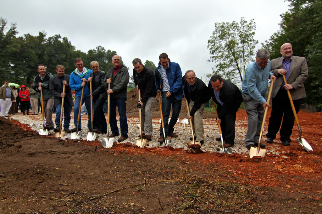
Rob Brothers, with the Walton Family Foundation, speaks during a groundbreaking ceremony held last week in Johnson.
Photo: Todd Gill
The nearly three-mile Clear Creek Trail is part of the Northwest Arkansas Razorback Regional Greenway, a 36-mile trail that will connect south Fayetteville to north Bentonville, and is funded by a grant from the Walton Family Foundation to the Northwest Arkansas Regional Planning Commission.
“Our work in Northwest Arkansas is all about improving quality of life,” said Rob Brothers, director of the Walton Family Foundation’s Home Region Focus Area. “We look at trails as having multiple purposes. They provide recreation and opportunity to get outdoors, but they also provide alternative transportation. So this is project is definitely a quality of life issue.”
Once complete, Clear Creek Trail will extend north from the Scull Creek Trail and Mud Creek Trail connection to pass under the Gregg/Wilkerson Bridge where it will continue north along Mud Creek. The trail will then extend east along Clear Creek just north of the Northwest Arkansas Mall. At Highway 71B, the trail will pass under the existing highway bridges and continue along the south side of Clear Creek to connect to the Lake Fayetteville Trail at the south end of the spillway bridge.
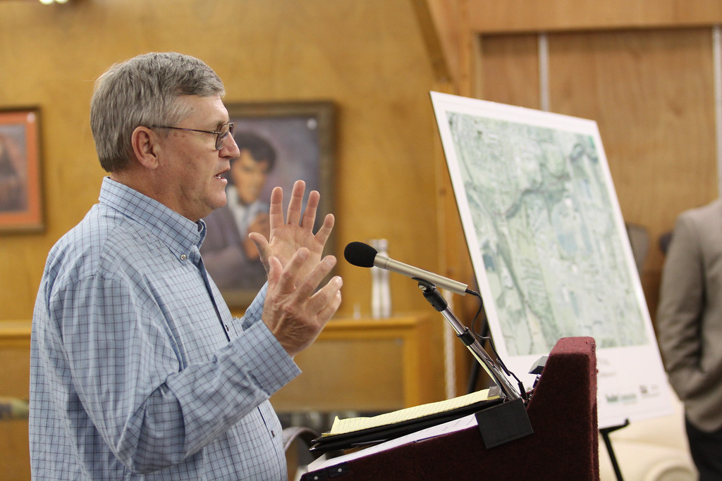
Several bridges and access points are planned including an extension that will connect to the west side of the Northwest Arkansas Mall near JCPenney. Access points are also planned at Wilkerson Street, Ball Street, and near the cell tower behind Dollar General on Main Drive.
While trails are nothing new to Fayetteville residents, Clear Creek Trail will be Johnson’s first.
“This is a great step forward for us,” said Johnson Mayor Buddy Curry. “I don’t think it’s the end.”
A nonprofit group, Johnson Clear Creek Trails, was created to manage the project and will continue trail efforts in Johnson, including securing funds for eventually extending the trail to Arvest Ballpark.
Fayetteville Trails Coordinator Matt Mihalevich said construction of Clear Creek Trail would likely last about a year, and that an in-progress project to close the paved loop around Lake Fayetteville Trail could be completed as early as spring 2013.


Johnson could’ve covered the cost from its ill-gotten ‘speeding’ ticket haul.
Amazing!! Just moved to Johnson and Main St. isn’t biker friendly. This will be great!
I’m just wondering if there are any trail spurs planned to connect the trail to Main Drive in Johnson? There’s a spur heading up to the mall. A spur heading in the opposite direction would connect all of the Johnson residents who live along Main Drive to the trail system. As shown in the above map, I don’t see how this trail is big news for the city of Johnson when it appears that the residents of Johnson have limited access.
Staff note: Several access points are planned. We’ve added a few specific locations to the story above.
@Landon Shockey – Bob Bova, director of Johnson Clear Creek Trails, said there would be several access points besides the spur at the mall. He said access is planned at Wilkerson Street, Ball Street, and near the cell tower behind Dollar General on Main Drive. I’ve added those specific points to my story above.
Johnson will have a major trail connection before Springdale has anything more than a crosswalk to nowhere on Meadow Street, which is the extent of their trail system to date (a trail sign, a crossing, a crossing signal and a button to push which is located awkwardly in an old grown-up planter with dying shrubs).
I’m getting concerned with how Springdale is ever going to pull this off.
RJ: Springdale is in construction on the trail from Lake Fayetteville up to the Shiloh Square on Emma Avenue, which is scheduled to be completed by December.
Is this on street trail?
I’ve looked at the trail map Springdale put on its website, and admittedly it is not very clear, but it shows the trail run from roughly the Lake Fayetteville educational center down Powell Street until Spring Creek and then cutting through to downtown at the Shiloh pavillion. Unless the trail is going to use the existing narrow sidewalk along Powell, I haven’t see where any work has been started.
Regardless, the crossing at Meadow is bizarre (you basically have to tromp through a shrub bed to push the button for the signal) and it doesn’t make since that a crosswalk and sign for the trail is installed before the trail itself is even built. At least the new crosswalk on Emma has existing sidewalks attached, the Meadow crossing ends in dirt and grass.
Good news, but now johnson needs to invest in complete sidewalks or bike lanes up Carley and Johnson road, so all the neighborhood people can safely get to the trail without having to walk/bike on those narrow roads.
What does the line of grey dots represent? The Fayetteville/Johnson border?
Yes.