Courtesy imagery
The Fayetteville City Council is considering revising the city’s ward boundaries. See the maps below for a closer look.
In an effort to allow the public to weigh in, the Fayetteville City Council voted unanimously Tuesday evening to table an ordinance that would revise the city’s ward boundaries.
John Goddard, city GIS coordinator, said the changes are needed to balance ward populations resulting from the 2010 Federal Census returns.
SUBSCRIBE: Get our free newsletter!
If approved, eight of the city’s precincts will be affected.
See the maps below for a closer look at the proposed boundary lines. For an interactive map, visit gis2.accessfayetteville.org/projects_2011/Proposed_Ward_Boundaries.
The council will return to the issue during its next regular meeting on Sept. 20.
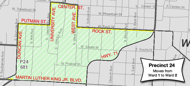
Precinct 24 – From Ward 1 to Ward 2
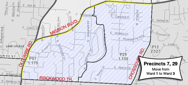
Precincts 7 and 29 – From Ward 1 to Ward 3
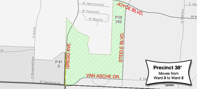
Precinct 38 (portion) – From Ward 3 to Ward 2
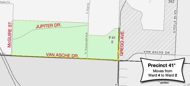
Precinct 41 (portion) – From Ward 4 to Ward 2
Precincts 1, 26, 35 – From Ward 4 to Ward 1