If you’ve been curious about the new mountain biking trails at Fitzgerald Mountain in Springdale, we’re here to help.
Fitzgerald Mountain
Opened: June 29, 2018
Funded: Walton Family Foundation
Constructed: Rock Solid Trail Contracting c/o NWA Trailblazers
Owned/maintained: City of Springdale and Springdale Water Utilities
Lots of folks have heard about Fitzgerald, but not everyone has had a chance to go and check it out. So we grabbed a bike, some cameras and a Strava app for mapping every last section of trail on the mountain – even a few lines that aren’t yet open for riding.
The $1.16 million system was funded by the Walton Family Foundation, and is built on 130 acres of land near Bayyari Park, which are owned and maintained by the City of Springdale and Springdale Water Utilities. It features 10 miles of soft-surface trails and includes something for everyone – from beginner-level biking and hiking trails, to intermediate cross country loops to some massive, double black diamond jump lines.
Beginner features
The beginner-level features are accessed from Bayyari Park, and include a small, gravel pump track next to the park pavilion. A 2-mile beginner loop (name TBA) is also located by the park, and serves as a great warmup run if you’re headed north across Dodd Avenue to the rest of the system. The loop also provides access to the jump lines.

There’s a nice map at Bayyari Park, but the beginner loop and jump lines aren’t currently represented (see our map below).

The pump track is located next to the pavilion at Bayyari Park.

The beginner loop includes a tunnel underneath an optional jump line bridge roll-in above.

The beginner loop also passes below a giant gap on the jump line above.
Jump lines
The jump lines are absolutely stunning, but be warned, they are very much expert-level trails with huge gaps and giant kickers. They are still under construction, but should be complete by the end of November. We took some photos, but you really need to seem them in person to get the full effect.

A bridge roll-in serves as the start to one of the jump lines.

Another look at the bridge roll-in.

A second jump line starts with a big gap over the beginner loop below.

Another look at the gap that starts the second jump line.

The jump lines include some really cool gaps and kickers.
Butterfield Trail
Butterfield Trail is an intermediate cross-country trail that provides access to four other trails on the mountain. It can be ridden as a 2.4-mile loop, or you can take it to the hub at the top of the mountain. It includes several dirt berms and a few optional gap jumps. You can ride in either direction, but it’s faster and feels more flowy when ridden counter-clockwise.

Cross Dodd Avenue from the beginner loop to access Butterfield Trail, Coyote Cave, Fitzgerald, 1857 and Best Trail Ever.

The trails north of Dodd Avenue include helpful signs and markers.

Butterfield Trail includes some optional jumps and other features.
Coyote Cave
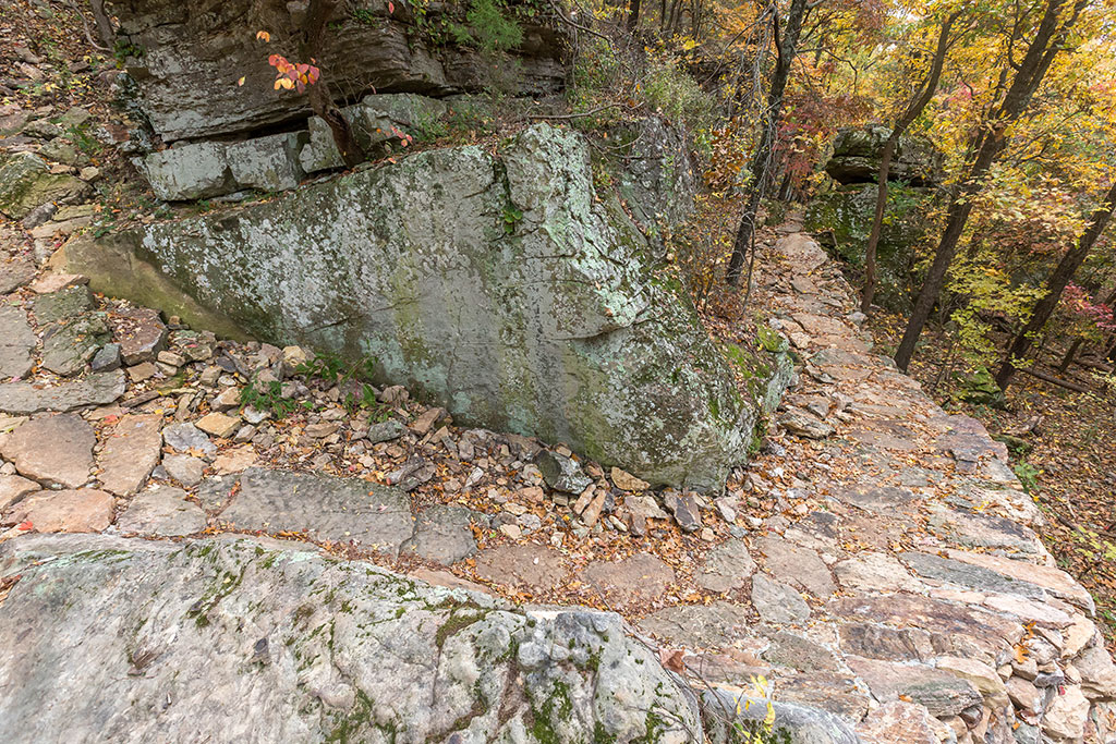
Coyote Cave is a 0.6-mile black diamond trail that’s accessed from either Butterfield near the bottom of the mountain or the hub at the top. The trail passes by several bluffs and a cave. Nearly half of the trail surface is placed rock. “Yellow Brick Road” as it’s sometimes called, makes up a portion of the trail and includes some amazing rock armoring, especially at the bluff peak near the top.

Lots of great rock work on Coyote Cave.

The cave is at about the halfway point of the trail.

Another look at the cave.

The rock armoring on Yellow Brick Road is amazing.

A large rock-armored chute rolls down from between two giant boulders on Coyote Cave.
Another look at the chute.
Fitzgerald
Fitzgerald is a 0.6-mile intermediate-level loop located on the top of the mountain and is accessed from the hub. You can get to it by taking Butterfield or Coyote Cave from the bottom of the mountain. The flat terrain is simple to navigate, and includes a nice bluff-top lookout point. It also serves as an access trail for two black diamond trails – 1857 and Best Trail Ever.
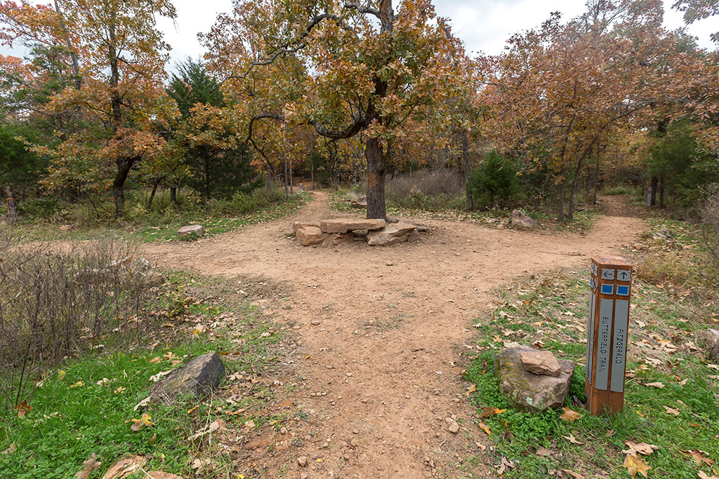
The hub at the top of the mountain provides access to Butterfield, Coyote Cave and Fitzgerald (which leads to 1857 and Best Trail Ever).

Fitzgerald has a nice bluff-top point overlooking northeast Springdale.
1857
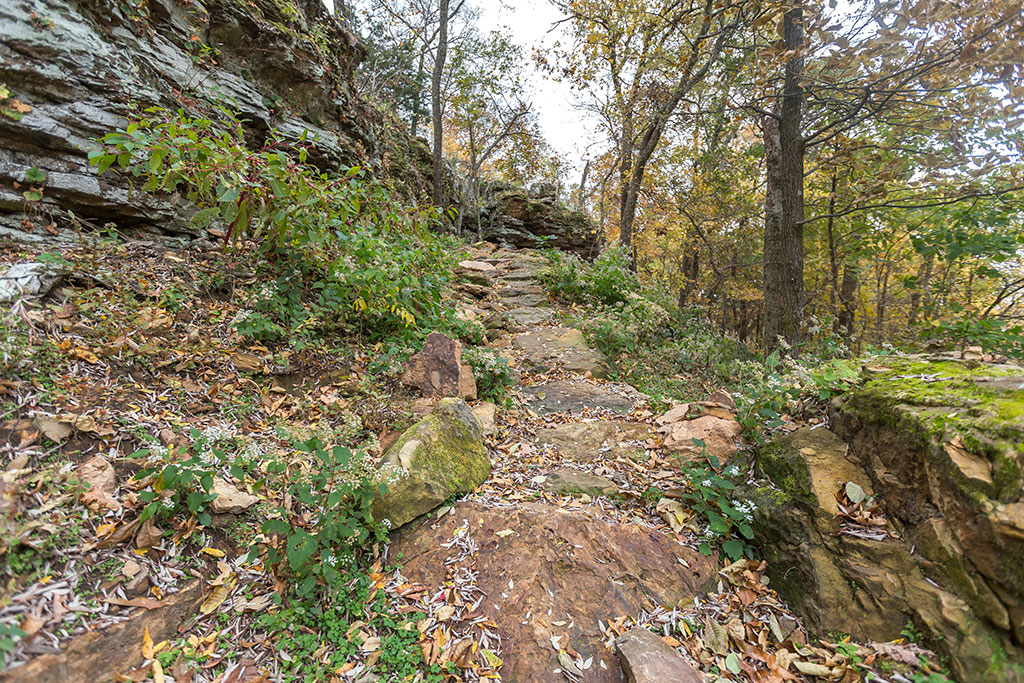
1857 is a 0.1-mile trail spur off of the Fitzgerald loop on top of the mountain. It’s a super technical rock garden that rolls down below the bluff and then climbs back up. We recommend riding it south, though either direction will work. Keep in mind this is an expert-level trail with steep rock sections that are very difficult to navigate. It’s certainly worth at least a hike on foot for the scenery alone.
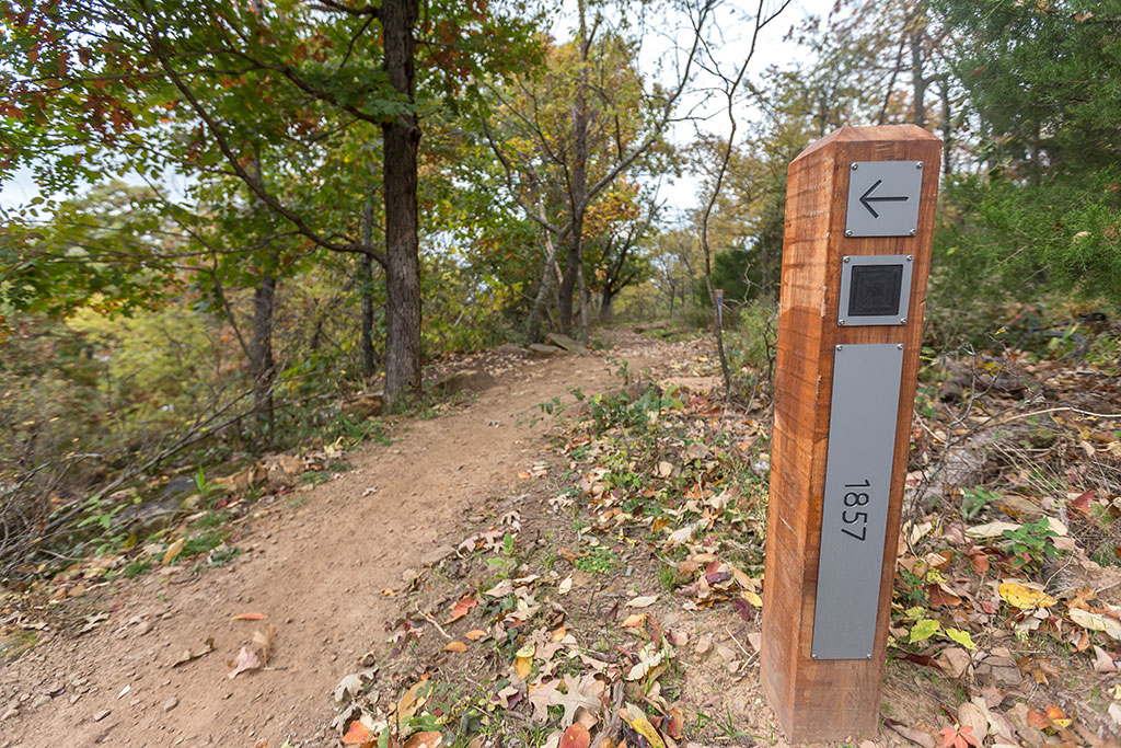
1857 is accessed from the Fitzgerald loop atop the mountain.

Looking down at 1857 as it rolls south back toward Fitzgerald.

Some great scenery along 1857.

A very difficult rock garden climb on 1857.
Another steep rock climb heading back up toward Fitzgerald.
Best Trail Ever
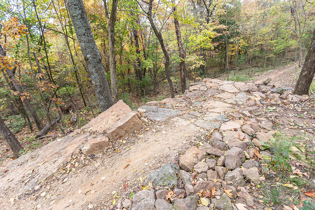
It’s a bold name, but the 2.75-mile Best Trail Ever probably comes as close as any trail to living up to its name. When ridden counter-clockwise, it begins fast and flowy with several optional gap jumps and an incredible rock wall ride. Next up is Turtle Bucket Climb, a 0.6-mile segment that features a series of technical uphill rock gardens, stonework switchbacks and some of the most extensive rock armoring you’ll find anywhere. The climb rewards you with some great scenery at the top, but be careful on the steep rock chute that begins the next downhill segment. The remainder of the trail includes more kickers and berms with a bit of flow, some sneaky, chunky rock gardens and one final climb with a few armored berms before ending right back where it started.
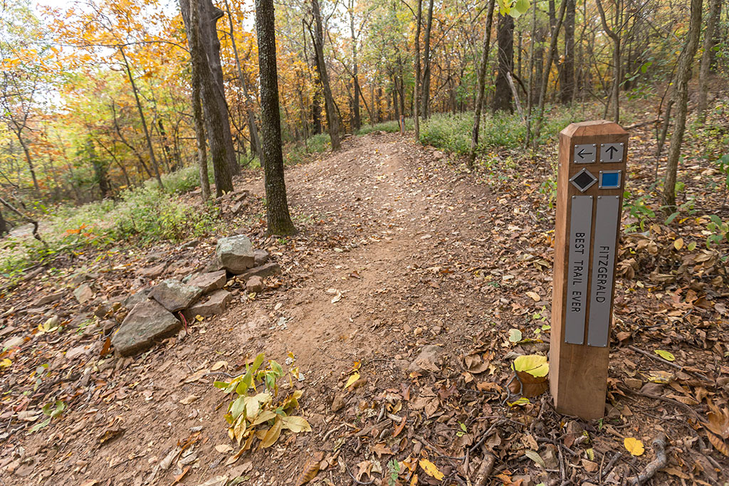
Best Trail Ever is accessed from the Fitzgerald loop atop the mountain.
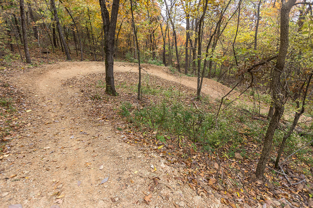
Some nice, big dirt berms on Best Trail Ever.
Lots of optional kickers and gaps on Best Trail Ever.

Another large, optional feature on Best Trail Ever.
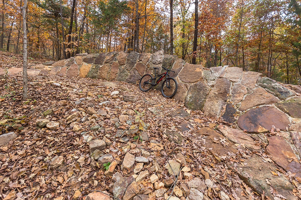
A giant rock wall ride on Best Trail Ever.
Map